Sunday 9 October 2011

Bathing area and latrine in Harappa town

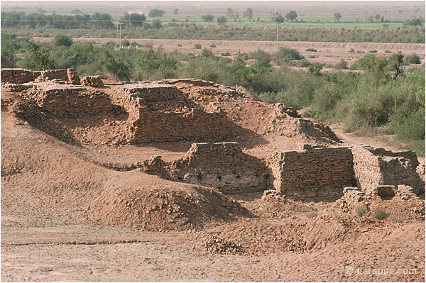
The bathing areas and walled latrine are located on the interior edge of the courtyard that touches the street. The drain from the bathinga area runs through the wall and falls directly into the street drain. Piles of firewood and an inverted cooking pot drying on a rack are seen on the left. 

Modern terraced courtyard in Harappa town

This courtyard of a modern house in Harappa town, has an upper level in front of the house that is plastered and has a small entryway that can be blocked to keep out animals. Drinking water is kept in earthenware pots on a wooden stand. The lower level of the courtyard is shaded by a large jujube fruit tree. Goats are tethered in the shade of the tree. In corner is an old oven (tandoor) being used as a shelf to hold water pots. Niches in the wall are used to hold lamps at night. 

Modern Latrine Drain at Harappa town

Latrines located inside a courtyard of modern Harappa town have drains that fall directly into the open street drain. (See Indus 1, Slide 12 for an ancient bathing platform.) 

Banded limestone ringstone, Mohenjodaro

This large ringstone is made of banded yellow and red-brown limestone. Sourcing studies of different varieties of limestone conducted by Randall Law, of the University of Wisconsin, Madison, suggest that this ringstone may have been brought to the Mohenjo-daro from quarries that have been located near the site of Dholavira in Kutch.  and Harappa ringstone in Indus.

White limestone ringstone

Numerous ringstones made from white limestone have been recovered from Mohenjo-daro. Sometimes several have been found together, but none are in their original position of use. Discoveries of similar ringstones in the gateways at the site of Dholavira (See the Ancient Indus Region Map in Indus 2, Slide 161.) suggest that they may have been used as the base of wooden columns. Small dowel holes are often found on one side. It is possible that several of the ringstones were stacked with a wooden pole running through the center. A miniature version of such a ringstone column made from shell rings has been reported from the site of Dholavira.]

Camels waiting to cross the Indus River near Mohenjo-daro

Although long distance travel on the Indus River is no longer feasible due to the construction of barrages and dams, local trade of firewood and other daily necessities is still moved up and down or across the river. Camels carrying grain wait for the ferry boat and an ox cart waits for passengers from across the river. A large pile of wood lies ready to be shipped down stream.

UM Area, unexcavated houses

These rooms of a house are located at the edge of the area excavated by Dr. G. F. Dales in 1964 (UM Area). The room has a nodule floor fill and clearly defined fired brick walls. These vitrified nodules were intentionally created as a form of artificial gravel for use in construction.
 

UM Area, Blocked lane

Empty spaces and alleyways in large cities like Mohenjo-Daro were used to dispose of trash and occasional unwanted bodies. This blocked lane in the UM excavation area had a human skeleton dumped unceremoniously at the juncture between the two buildings. 

UM Area, Massive mud brick platform and fired brick sizes

A large section of the mud brick platform in the UM Area was removed to be sure that it was not concealing other brick structures. The fired bricks of the upper buildings measured 7 x 15 x 29 cm (approximately 1:2:4 ratio), while those of earlier buildings at street level measured 6.5 x 13 x 26 cm (also approximately 1:2:4 ratio). This difference was thought by Dales to indicate a gradual increase in brick size over time, but at Harappa, the opposite pattern is found, with earlier bricks measuring around 7 cm thick while those of the later levels are around 6.5 cm thick. 

UM Area, and Citadel mound

The UM excavations conducted by Dr. G. F. Dales in 1964-65 exposed a massive mud brick platform on top of which were built numerous brick buildings separated by narrow lanes. The pottery excavated from this area was used to develop the most comprehensive analysis of Mohenjo-daro pottery published in 1986 by the University Museum Press (and now available on HARP). The citadel mound and Buddhist stupa are visible in the background. 

Covered Drains leading from the dyer's workshop, VS Area

A small drain leads from the well and finely fitted brick floor of the dyer's workshop to a covered drain at the edge of the street.

Terracotta drainpipes built into a wall, Lower Town

Many drains from upper buildings were directed to the street through enclosed channels or terracotta pipes. The pipes were made using multiple telescoping segments that fit snugly with the next segment.

Bathing platform, UM Area

A bathing platform in UM area with blocked up doorway leading into the room. The brick floor was made with carefully fitted flat paved bricks and a smaller catchment drain along the side of the platform. A small step was placed at one side of the platform, and a ledge of finely fitted bricks protected the base of the wall. 

Saturday 8 October 2011

Drain outlets, DK-I Area

Close-up view of ground floor drain outlet from the street side, showing a brick on edge with a notch was placed across the drain hole to keep objects from flowing out with the bath water. 

Bathing platform, DK-I Area

This bathing platform is located next to the street, and is made with bricks laid flat. A small drain running along one side of the bathing floor channels dirty water out to the street. A brick on edge with a notch was placed across the drain hole to keep objects from flowing out with the bath water. It is possible that such bathing floors were also used to wash clothes that may have washed out with the rinse water. 

Pipal-leaf shaped well, Lower Town

This unique well and associated bathing platform was discovered in the course of building a catchment drain around the site. It was reconstructed on the ground floor of Mohenjo-daro site museum. 

Private Well, DK-G

Each block of buildings at Mohenjo-Daro was supplied with one or more wells such as this one in DK-G Area. When archaeologists excavated the fill around the well they were left standing to show the final levels of use. 

Oval Well, SD Area

This oval well is located in room 19 northeast of Great Bath. It is the only well with an oval structure and may have been used to draw water for nearby bathing platforms or for filling the Great Bath. 

Large Well, HR Area

Wells were made with wedge shaped bricks to make a strong circular structure. Some bricks were made with special grooves to keep the ropes from sliding sideways when drawing water.

Small well and platform, VS Area

Small well and platform in VS area, with HR Area in the background and VS dyer's shop across the street to the right.

Limestone drain covers, SD Area

This large drain was partly covered along its length with large flat blocks made out of limestone from the Rohri hills, which are located to the north and on the other side of the Indus River.

Traffic control block and Street, SD Area

Looking south along the street to the east of the Great Bath. In the foreground is a unique brick platform with hollow sockets used to place upright beams that may have formed a gate or traffic control device. A large street drain covered with limestone blocks runs the length of the street.

Narrow streets, DK-G Area

The doors of later buildings can be seen in the upper levels of the wall to the left. The gradual tapering of the walls in the far right was an intentional architectural feature to avoid collapse of the upper floors.

Stairs leading to the second storey, DK-G Area

Some houses had small staircases leading to a second story or to a platform for pouring water into a bathing area.

Blocked Street to the east of First Street, DK-G Area

The excavations of DK-G area focused only on the section to the west of First Street. Unexcavated streets and houses lie to the east of First Street, waiting for a day when archaeologists have learned how to better preserve the fragile brick structures.

Chief's house, DK-G Area

The original walls in a large building complex referred to as the ChiefÕs house have been repaired and conserved. This view shows some reconstructed ground floor rooms and steps leading to a second story room.

Conservation and Remodeling, DK-G Area

Many of the original walls and features of the ancient buildings in DK-G area have been rebuilt and modified through conservation. The salt encrusted footings represent the original wall; a line of bitumen coated and red painted bricks serve as a damp proof course to protect the upper portion of the wall. The upper portion of the wall has been conserved with brick bonding that is not the same as the original wall. A stairway has been constructed to allow people to reach the tops of the walls for a better view of the area. 

Large Courtyard with mud brick filling, DK-G Area

This large room or courtyard was filled with a solid mud brick platform that was almost entirely excavated to investigate the underlying room. A section of the platform has been preserved beneath the tin roof on the left and part of the platform is still visible in the foreground and in the top right hand section. 

Remodeled walls, DK-G area

As houses were built on top of earlier structures, the windows and doorways were blocked up. Notice the changing alignments as the walls were remodeled. 

Looking down inside two rooms, DK-G area, near chief's house

This view into two small rooms shows tapered walls that were built to support a second floor. Later rooms were built directly on top of these walls because they provided a strong foundation. The wall of the building across the street shows multiple phases of rebuilding.

Wells and walls, DK-G Area

This general view of DK-G area shows multiple walls built at different time and two wells that were used up until the last phase of occupation. 

Dyer's Workshop, VS Area

This room in VS area was made with bricks set on edge to create a watertight floor. A small well was located in the southeast corner (top right) and circular brick depressions were set into the floor, presumably to hold pottery vessels. The early excavators suggested that the room might have been a dyer's workshop.
 

HR area, large courtyard (room 70)

In some neighborhoods, large courtyards were connected to numerous smaller buildings built at different levels. The pilastered wall on the left supported houses at a higher level. A large corbelled arch drain that was later blocked is seen emerging from a wall in the background. 

HR area, Dead man's lane and First Street

The small lane at the left side of the photograph was called Dead Man's Lane because of the discovery of a single Skelton where the wall juts out into the lane. The large street running north south is First Street. The room with the so-called massacre victims  is on the west side of the street (at the right edge of the photo). 

Toilet, HR area

Toilets would have been an essential feature in Mohenjo-daro, but the early excavators identified most toilets as post-cremation burial urns or sump pots. This brick structure  had a hole in the top that was connected to a small drain leading out of the base into a rectangular basin (not reconstructed). Early excavators suggested this might have been a toilet. 

Well surrounded by paving, DK-B area

This well located in DK-B area was originally surrounded by a paving that has recently been reconstructed. 

Steps at House I, HR area

In the lower courtyard was a circle of bricks (barely visible in the foreground), which might have been the site of a sacred tree. The walls in the right foreground may have been part of a large water tank. 

House I, HR area

House A1 may have been a temple or palace of an important leader. Two doorways lead to a narrow courtyard at a lower level. A double staircase leads to an upper courtyard surrounded by several rooms. This house had numerous seals and fragments of a stone sculpture depicting a seated man wearing a cloak over the left shoulder. 

Western Staircase, House I, HR area

Many houses had stairs leading to upper courtyards of the building or to a second floor. This house in HR area had a double staircase that would allow people to enter and exit the upper courtyard in an orderly fashion. Some scholars feel this may have been a palace or a temple. 

View of well to the east of the Granary

Looking from the top of the granary towards the remains of two wells and the wall that were constructed in the area to the north of the structure. The drain from the great bath would have run along the modern pathway. 

Granary, SD and REM area

Built on top of a tapered brick platform, this building had a solid brick foundation that extended for 50 meters east west and 27 meters north south. The foundation was divided into 27 square and rectangular blocks by narrow passageways, two running east west and eight running north south. A section of the northern foundation had hollow sockets for wooden beams used to support a stairway or wooden structure. Later wells and walls are seen in the foreground. 

Gateway (ACC Area) with Stupa in background

A massive block of brick architecture at the southeast corner of the Ã’citadelÓ mound was thought to represent a gateway with large brick bastions. Later construction of a wall (in the center of the photo) blocked the entryway. 

College Building Courtyard, SD Area

A large open space or courtyard (10 meters square) is surrounded by a wall that had 13 openings, possibly for windows. This unique structure is situated in the northern part of an extremely large building complex containing around 78 rooms and passageways, but no well. The building lies to the east of the Great Bath and was thought to be a "college" or residence of priests. 

Indus River at Mohenjo-daro


Rice fields almost ready for the fall (kharif) harvest reach to the edges of the Indus River near Mohenjo-daro. The flood plain on the far side of the river is covered by a vast scrub forest that would have supplied the ancient inhabitants with firewood and good hunting.